


![]() Wildfire season is here. Approximately 85 percent of WA's wildfires are caused by people. Do your part to protect your parks. Before visiting, check park alerts and burn restrictions before lighting any fires.
Wildfire season is here. Approximately 85 percent of WA's wildfires are caused by people. Do your part to protect your parks. Before visiting, check park alerts and burn restrictions before lighting any fires.
No fires permitted at any time.
Emergency Closure: The Palouse to Cascades Trail will be closed near Lake Easton between Monahan Rd and Stampede Pass Rd from June 22 to July 13, 2026. During the winter there was a landslide that required this section of the trail to close. This closure is for large equipment to access the site to help with the stream diversion. There is no detour for this section.
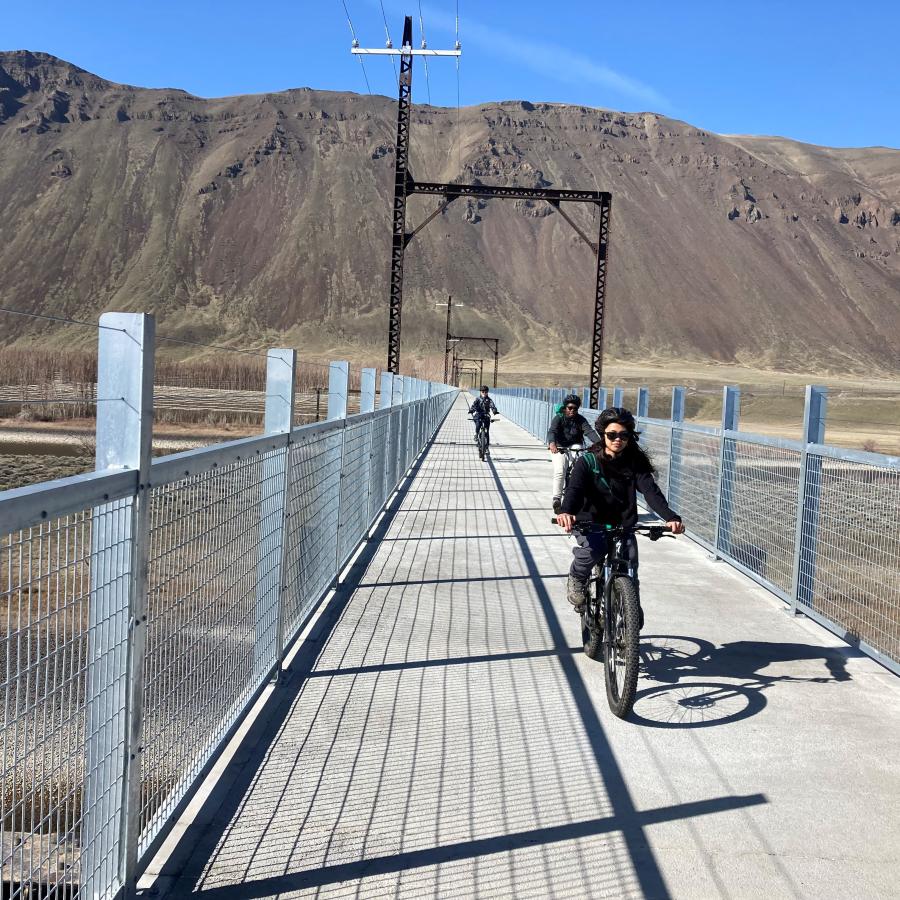
The western portion of the Palouse to Cascades State Park Trail near the Mount Washington Trailhead is officially reopening June 5, 2026. We have completed construction of a new 350-foot long, 36-inches wide bypass trail around a storm-damaged trail section. The bypass is open to pedestrians, cyclists and equestrians. Cyclists are asked to dismount and walk their bikes along the 350-foot bypass before remounting on the original trail. Learn more about the project here.
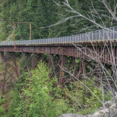

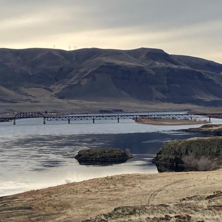
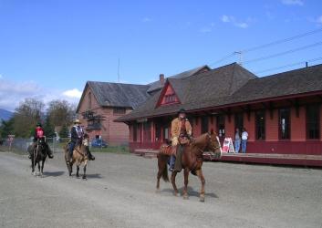
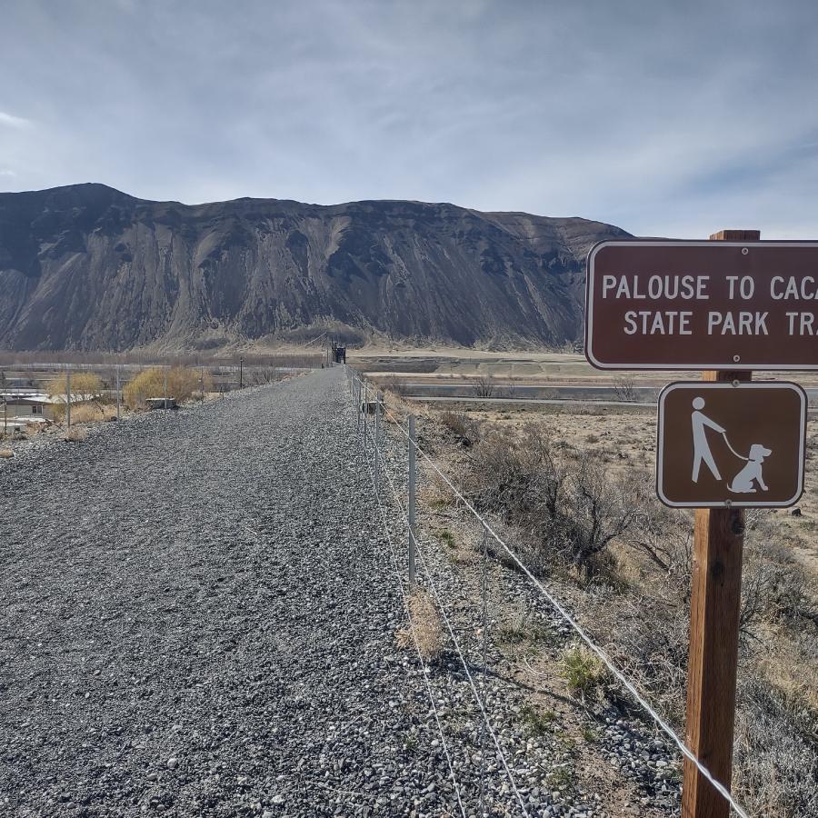
The Palouse to Cascades State Park Trail (also known as the "PTCT") gives hikers, cyclists and equestrians an unconventional way to explore a variety of environments, flora and wildlife. Explore the forested Cascade Mountains to the arid shrub-steppe of eastern Washington. Sitting on the historic Chicago-Milwaukee-St. Paul-Pacific Railroad corridor, nicknamed the "Milwaukee Road," this 251-mile trail runs in sections from Cedar Falls near North Bend east to the Idaho border.
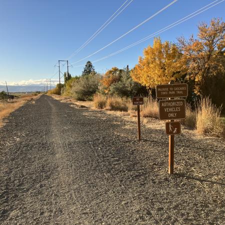
To use the East section of the trail (from Warden to the Idaho border), you must pre-register online. For more information, visit the trail registration information page. If your group is larger than 20 people, please call us at (509) 337-6457.
Staying on the trail is crucial for all trail users. Adjacent properties are not open to the public. Going off trail is trespassing on private property.
Parts of the trail may have construction, missing trestles or pass through private property. Make sure you check for detours and closures before heading out.
No motorized vehicles are allowed on the trail except for snowmobiles in the winter. You may ride your snowmobile only from Stampede Pass Road to Cabin Creek.
Learn about seasonal closures and operational changes during the off-season on the Winter Schedule page.
The Snoqualmie Tunnel is closed from Nov. 1 - May 1, the re-opening date is weather dependent.
A Sno-Park Permit is required at all Sno-Parks from Dec. 1-March 31
Biking
Bird Watching
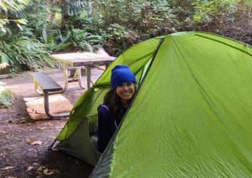
Camping
Fishing
Geocaching
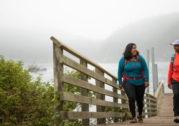
Hiking, Walking, Rolling and Running
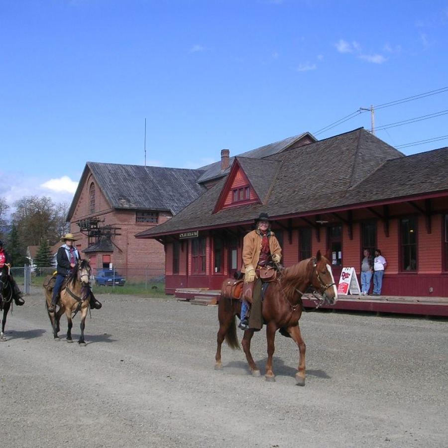
Horseback Riding
Rock Climbing
Winter Activities
Automated Pay Station
Accessible Restrooms
Restrooms
Picnic Tables
Accessible Parking
Parking
Interpretive Opportunities
Sno-Park
Accessible Trails
Long Distance Trail
Bike Trails
Equestrian Trails
Hiking Trails
Creek
Forest
Freshwater
Lake
Meadow
Mountain View
River
Seasonal Wildflowers
Viewpoint
Waterfall
Wetland
Wildlife Viewing
To use the East section of the trail (from Warden to the Idaho border), you must pre-register online. For more information, visit the trail registration information page. If your group is larger than 20 people, please call us at (509) 337-6457.
Staying on the trail is crucial for all trail users. Adjacent properties are not open to the public. Going off trail is trespassing on private property.
Parts of the trail may have construction, missing trestles or pass through private property. Make sure you check for detours and closures before heading out.
No motorized vehicles are allowed on the trail except for snowmobiles in the winter. You may ride your snowmobile only from Stampede Pass Road to Cabin Creek.
Learn about seasonal closures and operational changes during the off-season on the Winter Schedule page.
The Snoqualmie Tunnel is closed from Nov. 1 - May 1, the re-opening date is weather dependent.
A Sno-Park Permit is required at all Sno-Parks from Dec. 1-March 31
The PTCT is split into three sections, West, Central and East. Each section offers unique experiences with varying degrees of difficulty due to surfacing variability, limited services and gaps in public ownership.
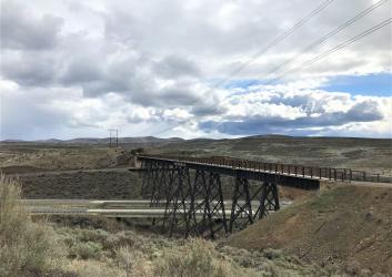
Scenery and activities will vary depending on what time of year you take the trail. In the spring and summer, you'll pass by small waterfalls, farmland, historic train depots and travel through former train tunnels and over high trestles and bridges. Experience vibrant changing colors and golden fields if you travel during the fall. The winter season opens up options for cross-country skiing, snowmobiling, dog sledding and snowshoeing depending on location and conditions.
The PTCT is not a fully improved, continuous "cross state" trail. Several sections are closed to public access due to safety concerns, active rail use and private property. Exploring the PTCT requires informed planning and preparedness and, in the eastern section, pre-registration. Please familiarize yourself with the trail before visiting.
We are actively working to improve and adapt the PTCT for recreational use, which makes it a dynamic state park with ongoing projects that that could temporarily impact access.
Click here to visit the Palouse to Cascades State Park Trail Visitor Information Map for more information about surface condition, trail ownership gaps and closed bridges.
North Bend area to Snoqualmie Pass Tunnel, 18 miles.
The West section of the PTCT is also the most improved for recreational use. This section starts in King County at the Cedar Falls Trailhead (milepost 2136) and continues east to the 2.3-mile-long Snoqualmie Tunnel (milepost 2117).
Snoqualmie Tunnel to Royal City cut-off, 107 miles.
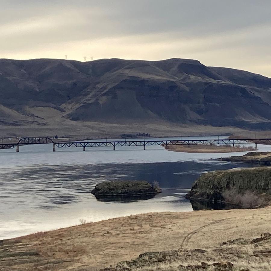
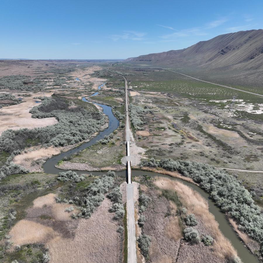
The Central section of the PTCT begins at the Snoqualmie Tunnel and continues east through Ellensburg. Continue over the Columbia River on the recently renovated Beverly Bridge. This section ends at Royal City cut-off (milepost 2010).
Warden to the Idaho border, 126 miles.
The East section of the PTCT is the most variable and remote section requiring pre-registration before you visit. This section includes several areas that are closed to public access, requiring detours and more involved trip planning and support.
Please note: Washington State Parks recognizes that not all features of the map may meet website accessibility and assistive technology standards. We have included this map as one of many resources for finding accessible recreation opportunities at our parks. If you cannot access this map, please call our State Parks Information Center at (360) 902 - 8844.