Palouse Falls, Lyons Ferry & Lewis and Clark Trail Classification and Management Planning
Project summary
In 2018, State Parks initiated a planning process to update the land classifications and long-term boundaries at three parks located within the Blue Mountain Area: Palouse Falls, Lyons Ferry, and Lewis and Clark Trail. The Commission adopted the recommended updates to the land classification and long-term boundaries for these three parks in January 2021. Staff is currently developing the management plan for these three parks, which serve as a resource to staff to help implement the plan, as well as provide information that may be of interest to the public. A draft plan is expected to be completed in late 2025.
- Location: Lewis and Clark Trail State Park Palouse Falls State Park Heritage Site Lyons Ferry State Park
Parks staff began development of the management plan in late 2023 with a review of issues and concerns and re-engaging the Tribal Workgroup. The draft plan is currently being developed in collaboration with the Tribal Workgroup. Staff hopes to have a completed plan for Director approval by the end of 2025.
Palouse Falls State Park
Palouse Falls State Park is a 105-acre camping park with unique geology and history. The park is located on the Palouse River in Franklin and Whitman counties and offers a dramatic view of one of the state's most beautiful waterfalls. Palouse Falls drops from a height of 198-fet with high volumes of water flow in spring and early summer.
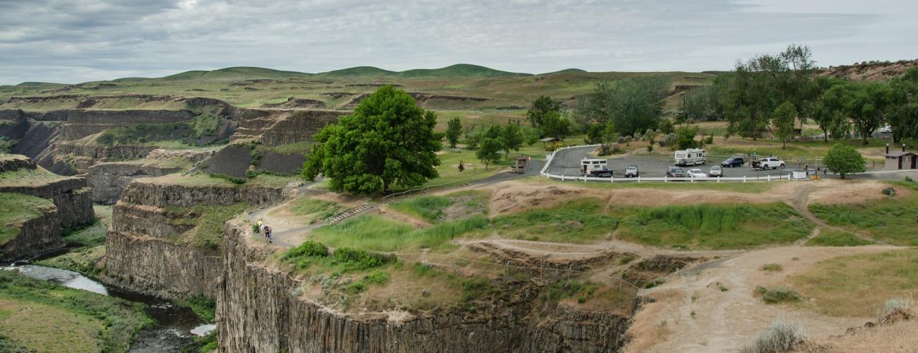
Lyons Ferry State Park
Lyons Ferry is a 168-acre day-use park located in Franklin County at the confluence of the Palouse and Snake rivers. The park has more than 5,200 feet of shoreline and offers a variety of activities, including boating, fishing, hiking, and swimming. Lyons Ferry was named for the ferry crossing that operated across the Snake River from the mide-1860s until the late-1960s, when it was replaced by the Lyons Ferry Bridge, also known as the Snake River Bridge.
Lewis and Clark Trail State Park
Lewis and Clark Trail State Park is a 37-acre camping park with 1,333-feet of freshwater shoreline on the Touchet River. It is located just outside of Dayton in Columbia County. The park is a rare treasure of old-growth forest and river in the midst of the surrounding arid grassland. The park offers camping and day use including picnicking, walking, and nature viewing.
Project history
Stage One - Identify issues and concerns
The purpose of this stage is to understand what is important to the park community and provides a sense of the issues that need to be considered through the planning process. Stage one of the CAMP process was conducted in 2017 and 2018. See the Stage One documents below for more information.
Stage Two - Exploring alternative approaches
At this stage, the planning team suggests potential alternative approaches to address the various issues and concerns raised by people in stage one. No preferred alternative is established; rather this is an opportunity to understand the range of possibilities.
A virtual public meeting was held in late 2020 to hear questions and comments about three different themes for the future management and development of the Parks.
Stage Three - Preparing preliminary recommendations
The best ideas from the alternative approaches developed in stage two are combined into a preliminary plan in this stage. The plan includes recommendations for use and development of land, changes to property boundaries and ways to address issues raised during the planning process. Another important document completed at this stage is the State Environmental Policy Act (SEPA) checklist that describes environmental impacts of the recommendations.
Stage Four - Preparing final recommendations
At stage four, final adjustments are made to recommendations and submitted to the seven-member Parks and Recreation Commission for approval. The public is encouraged to attend the Commission meeting and provide testimony or to provide written comment.
In January 2022, The State Parks and Recreation Commission adopted the final recommendations to:
-
Adopt the long-term boundary and land use classification recommendations for Palouse Falls State Park, Lyons Ferry State Park, and Lewis and Clark Trail State Park.
-
Permanently close the area at Palouse Falls State Park known locally known as Castle Rock as well as the access to the cliffs and plunge pool of the falls; and
-
Approve park name change from Palouse Falls State Park to Palouse Falls State Park Heritage Site.