Columbia Plateau State Park Trail History
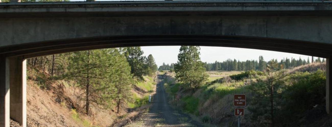
The 130-mile Columbia Plateau State Park Trail weaves together a diverse parade of landscapes filled with stories of land and people along the route of the abandoned Spokane, Portland and Seattle Railway. The trail stretches through a swath of today’s eastern Washington, from ponderosa pine forests near Spokane across the volcanic “scablands” and into the deep canyon of the Snake River.
A Flood of Lava
About 17 million years ago, lava began oozing up through cracks in the earth near the present-day Washington-Oregon-Idaho border. This happened repeatedly, often with thousands of years passing between flows. In total, the lava flows—more than 300 of them—produced layers of basalt rock almost two miles thick that cover about 40% of present-day Washington, creating the distinctive layered bluffs and canyons that the Columbia Plateau Trail traverses.
Careful observation of the landscapes along the trail will reveal distinct types of structures in the long-cooled lava. Large, vertical colonnades, vertical pillars typically having six sides, are often topped with a thicker mass of rock with random, messy-shaped rocks, called an entablature. Both types of rock are basalt, but the colonnade portion of the flow cooled slowly, allowing time for the orderly release of energy and formation of uniform structures. The overlying entablature probably cooled much faster, perhaps as it was covered by water that had initially been displaced by the lava flow.
Channeled Scablands
In the final stages of the most recent Ice Age, masses of glacier ice repeatedly blocked meltwater drainage to the north of the route of the Columbia Plateau Trail, creating huge bodies of impounded water in northern Washington, Idaho and Montana. When the ice dams melted or were breached by the sheer weight of water behind them, gigantic Ice Age floods swept over the landscape of today’s eastern Washington.
Dozens of times over thousands of years, ice dams formed and gave way, sending floods racing toward the Pacific Ocean. The floods scoured the land, stripping vegetation and soils to leave bare rock surfaces. The rushing waters also carved cataract cliffs with plunge pools at their base, rock benches, mesas, buttes, potholes, and channels (“coulees”) deep into thick layers of basalt across the Columbia Plateau. Where the water slowed, it deposited gravel to form flood bars (some with giant ripple marks sculpted by the currents), that would one day be used as a source of raw material for the construction of railroad grades. The landscape came to be known as the “channeled scablands.”
In some areas, the volume of water was so immense that it overtopped existing passageways, tearing through basalt to rapidly form new deep canyons, as at Devil’s Canyon, through which today’s Columbia Plateau State Park Trail passes.
Indigenous Lands
The Columbia Plateau State Park Trail meanders through the traditional territories of many of the region’s Indigenous people. The route lies within the traditional territories of Sahaptian and Interior Salish Indigenous people whose present-day descendants include members of the Confederated Tribes and Bands of the Yakama Nation, Confederated Tribes of the Colville Reservation, Spokane Tribe of Indians, Confederated Tribes of the Umatilla Indian Reservation, Nez Perce Tribe and Coeur d’Alene Tribe.
Ancestors of today’s tribal members traditionally followed a seasonal round throughout the area of eastern Washington, maximizing access to necessary resources by spending time in each area at the optimal time for harvesting the foods and materials featured in each ecosystem. Most spent winters in lower elevation areas with better protection from harsh weather, such as the shores of the Snake River.
All of the tribes utilized parts of the route traversed by today’s trail to reach important resources and connect with other people for trade and social gatherings.
Dispossession and Land Disposal
Representatives of numerous Indigenous people with traditional territories in what is now eastern Washington negotiated and signed treaties with Territorial Governor Isaac I. Stevens at Walla Walla on June 9, 1855. The treaties were not ratified by the US Senate until 1859, and in the interim, the benefits promised by the treaties were not available to the tribes that had signed.
The discovery of gold in the Colville area resulted in numerous Euro-American prospectors entering onto unceded Indigenous land, sometimes coming into conflict with residents. A government agent sent to investigate the incidents, Andrew Bolon, was killed by a party of Indigenous warriors.
In response, the US Army unsuccessfully sent soldiers into the area to apprehend those involved, initiating what came to be known as the Yakama War. After several skirmishes and a widening of the conflict into the Puget Sound area, Colonel George Wright was ordered to “attack All the hostile Indians you meet, with vigor; make their punishment severe and persevere until the submission of all is complete.”
Armed with new, highly accurate rifles, Colonel Wright’s forces decisively defeated the allied tribes at the Battle of Spokane Plains (about 10 miles northwest of the northern terminus of today’s Columbia Plateau Trail) on September 5, 1858.
In the days following the battle, Colonel Wright ordered the destruction of the Indigenous people’s food stores, nearly 1,000 horses, and their dwellings. The atrocities culminated in the summary execution of some Indigenous leaders later the same month.
The lands taken from Indigenous residents became federal public domain lands. The lands were surveyed by government surveyors over the next few decades following the pattern established by the Land Ordinance of 1785, with the land divided into one-square-mile (640 acres) units called “sections” grouped into 36-square-mile units called “townships.”
The land in the townships was distributed by the US General Land Office to people that qualified to receive it under terms of land disposal laws passed by the US Congress.
- About 20% of the land was sold directly to individuals with the means to buy it at a cost of $1.25 per acre under terms of the Land Act of 1820. A small portion was granted to military veterans with service before 1855.
- About 30% of the land was “proved up” under terms of the Homestead Act of 1862, which gave title to up to 160 acres of land to anyone who cultivated some of their claim, built a residence and lived on the site for at least five years. Another 10% of the land was claimed, in larger allotments, by persons who developed irrigated agriculture on their properties.
- About 5% of the land was granted to the State of Washington at statehood in 1889 for the support of public institutions such as schools and universities.
- Nearly 35% of the land was granted to the Northern Pacific Railway, part of a grant of millions of acres to subsidize construction of rail lines into the western states.
The Northern Pacific Railway (NP) was completed through Washington in 1886, providing an economic stimulus to further settlement and development, while producing enormous profits for its owners and investors.
Other capitalists sought to benefit from the expanding population and production in Washington by financing and developing competing railroads. The Great Northern Railway (GN) was completed in the early 1890s, and the Chicago, St Paul & Milwaukee Railroad (“The Milwaukee Road”), now the route of the Palouse to Cascades State Park Trail, extended its line from South Dakota to Washington beginning in 1905.
Railroad Competition
As the Milwaukee Road surveyors planned their route into Washington, they sought a route with the least overall distance and gentlest grades, so they could carry more freight on a faster schedule than the existing lines. A route across the channeled scablands of the Columbia Plateau and through the Columbia River Gorge would provide that, as well as avoiding the high cost to maintain tracks through the deep winter snow accumulations in the Cascade Mountains.
At the same time, the NP and the GN Railways desired the same route to improve their service to Portland, which was the largest city in the Pacific Northwest at the time. The two joined forces to keep the Milwaukee Road from using the corridor, and jointly established the Spokane, Portland and Seattle Railway to build and operate the line in 1905. The “golden spike” that completed the western portion of the line from Pasco to Portland was driven on March 11, 1908, at milepost 50.5 near today’s Beacon Rock State Park.
On the “Third Subdivision” of the line, connecting Pasco to Spokane (today’s Columbia Plateau State Park Trail), engineers were instructed to survey the shortest possible line that could be built with no grade in excess of 0.4%. With the survey completed and land purchased, construction began in the spring of 1907. Track laying began in 1908, with crews working northward from Pasco and southward from Cheney.
The two ends of the track reached opposite sides of Box Canyon (near today’s Lower Monumental Dam) on December 10, 1908, but the tracks could not be connected until the trestle was completed on February 4, 1909. The trestle was an engineering challenge, stretching over 1,200 feet long while soaring more than 200 feet above the deep Ice Age-flood-carved canyon below. Regular scheduled service between Pasco and Spokane began in May 1909.
The NP developed the Texas Ferry Branch, following the course of the Snake River from Snake River Junction to Lewiston, ID, by building a line which paralleled the SP & S line for 15 miles to Devil’s Canyon, making the twin trail routes on today’s Columbia Plateau Trail in that section.
Changing Transportation Needs
Declining population and development growth in the Pacific Northwest and significant freight competition from the Panama Canal, which opened in 1914, limited the railroad’s traffic. Revenues increased after industrial plants were built along the Columbia River during and after World War II, as factories took advantage of plentiful, inexpensive hydroelectric power to manufacture aluminum, chemicals, lumber, and transfer grain and other agricultural products.
The NP, GN, and SP & S railways merged in 1970, part of a nationwide trend toward consolidation of railroad operations and ownership. The same year saw the closure of most of the railroad stations along the Third Subdivision, as freight shippers increasingly chose to ship their commodities by truck or barge instead of rail. Those trends intensified, leading to the end of service along the Third Subdivision in the late 1980s.
Making a Park
In 1983, concern over the rapid abandonment of thousands of miles of US rail corridors like the SP & S Third Subdivision spurred the US Congress to pass an amendment to the National Trails System Act to preserve rail corridors through a process called “railbanking.” Corridors that would otherwise be abandoned and converted to other uses could be preserved for future rail use by converting them to interim trails.
The SP & S Third Subdivision was railbanked on May 8, 1991, through the efforts of the Rails to Trails Conservancy, a national organization with a mission to acquire rail corridors as they were being abandoned, holding title to the right-of-way until they could be transferred to a public agency capable of managing the route for trail use. Ownership was transferred to the Washington State Parks and Recreation Commission on June 12, 1995.
Sharing the histories of Washington’s state parks is an ongoing project. Learn more here.

