Westport Light State Park History
Westport Light State Park encompasses the southern point at the entrance to Grays Harbor. The point is a constantly changing bit of land, at the whim of sand and waves. The name of the point has fluctuated, too, finally landing on Point Chehalis, using the tribal name of its original people, translated as People of the Sand.
The Coast—Accretion and Erosion
Modifications to the natural ebb and flow of sand on the coast have come from dams that trap sediment on the Columbia River, dredging of navigation channels at the mouth of the Columbia River and the entrance to Grays Harbor, and the construction of rock jetties that help mariners safely pass in and out of harbor and river mouth.
At Westport Light State Park, the most significant effect comes from the South Jetty at the entrance to Grays Harbor. Since its construction from 1898-1902, the structure has been a barrier for northward-migrating sediments, initially adding 3,000 feet of new land to the west side of Point Chehalis by accretion. As the jetty deteriorated, the shoreline receded 2,700 feet from erosion of the exposed beach. Jetty rehabilitation projects in 1935 and 1966 repeated cycles of accretion and erosion, but over time, hundreds of acres have been added to the area now making up Westport Light State Park.
Indigenous Lands
The park lies within the traditional territories of Coast Salish Indigenous people whose present-day descendants include members of the Confederated Tribes of the Chehalis Reservation, Shoalwater Bay Indian Tribe and Quinault Indian Nation. For thousands of years this area has provided habitat for a diverse community of life that forms the basis of their cultures.
At the Chehalis River Treaty Council in February 1855, Territorial Governor Isaac Stevens proposed that all of the region’s Indigenous people live together on one reservation near the mouth of the Quinault River, far from the inland areas that many people relied on for subsistence. Members of the Quinault Indian Nation eventually accepted the terms, under duress, but others refused. Subsequently, title to the land was relinquished to the US federal government and the Chehalis Reservation was established by executive order of Secretary of the Interior J. P. Usher on July 8, 1864. On September 22, 1866, President Andrew Johnson established the Shoalwater Bay Reservation by executive order.
Government surveys were completed in 1858 and some of the land in today’s park passed into private ownership as Military Scrip Warrants. A veteran with service before 1855 (or his heirs) could obtain 160 acres of public domain land as a reward for military service. Such scrip warrants were transferrable, and many patents went to warrant brokers, who in turn sold them to bargain-conscious land buyers. In 1861, Aaron Bickford received land at Point Chehalis for his service in the War of 1812. In 1864 a Military Scrip Warrant was given to Wesley Howell for his service in a volunteer militia with Captain Hamilton Maxon. Maxon’s command may have perpetrated war crimes against noncombatant Nisqually tribal members in 1856 near the site of today’s Nisqually State Park. Other lands making up today’s Westport Light State Park were claimed as Cash Entry Patents in 1864.
Westport Light and US Coast Guard
The US Congress approved an appropriation in 1895 for establishing a lighthouse on Point Chehalis. The owners of the selected property were unwilling to sell, so the Lighthouse Board initiated condemnation proceedings and paid $500 for the property on December 16th of the same year. Architect Carl W. Leick designed the structure, abiding by a motto sometimes attributed to him: “Build ‘em stout, and make ‘em last.” At 107 feet, it is the tallest lighthouse in Washington. When it went into service in 1898, the tower stood 400 feet from the high tide line. Since then, accretion has moved the shoreline 3,000 feet to the west.
In 2004, the Westport-South Beach Historical Society was granted ownership of the lighthouse under terms of the National Historic Lighthouse Preservation Act to preserve the structure and make it available to the public.
Grays Harbor Military Reservation
In 1918, during World War I, the Grays Harbor Military Reservation was established on two land parcels adjacent to today’s Westport Light State Park. Six stationary guns were installed for Harbor Defense, including two 5” M1897 guns mounted on barbette (raised platform) carriages transferred from Fort Flagler. On October 26, 1921, the site was placed on caretaker status and all armaments were removed.
After the December 7, 1941, attack on Pearl Harbor, US Army field artillery units from Fort Lewis were deployed to the reactivated Grays Harbor Military Reservation with field mounted guns. Grays Harbor was not attacked during World War II, and the Harbor Defense was deactivated on January 8, 1944.
A State Park to stroll the Beach or Bluff
The Washington State Parks and Recreation Commission (WSPRC) acknowledged the demand and need for additional public recreation areas on the Pacific Ocean. The first step toward establishment of Westport Light State Park was the acceptance of a land donation from the Port of Grays Harbor in 1968. Due to changes in the shoreline, the parcel was surplus to the needs of the port, and it was dedicated as Westhaven State Park on June 24, 1968.
In 1973, 232 acres of the US Coast Guard Reservation surrounding the Westport Light were transferred to the WSPRC under terms of the Federal Land to Parks program and established as Westport Light State Park on February 23, 1975.
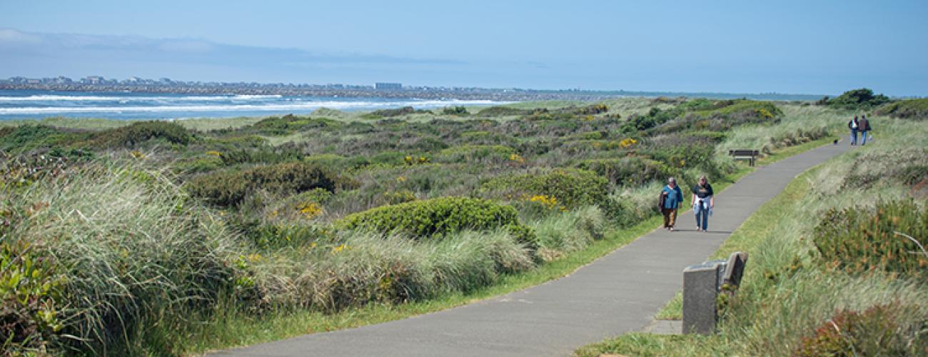
On November 1, 1993, the 1.5 mile Westport Light Trail was completed between the Westport Lighthouse and Westhaven State Park, offering an easily accessible route to walk or ride along the bluff overlooking the ocean shore.
In 2015, the WSPRC purchased 293 acres situated between the two existing parks and renamed the entire unified park Westport Light State Park.
Sharing the histories of Washington’s state parks is an ongoing project. Learn more here.

