Steamboat Rock State Park History
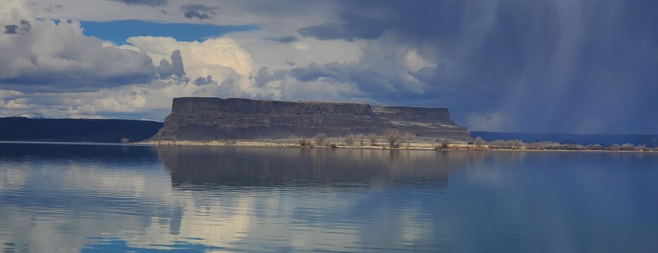
Steamboat Rock State Park preserves spectacular features of the Columbia Plateau Ice Age Floods. The 800-foot-tall butte of Steamboat Rock, sheer cliffs, and scoured coulees are remnants of a series of flood events that completely dwarf the imagination.
Indigenous Lands
This park’s location in the coulees of the Columbia Plateau lies within the traditional territories of Sahaptian and Interior Salish Indigenous people whose present-day descendants include members of the Confederated Tribes of the Colville Reservation and the Confederated Tribes and Bands of the Yakama Nation. For thousands of years the surreal landscape of the upper Grand Coulee and the plateau lands that surround it have provided a habitat for a diverse community of life that forms the basis of their cultures. Shrub-steppe landscapes of the Grand Coulee provide important root collection areas for biscuitroot (Lomatium canbyi) and bitterroot.
The natural universe and its rhythms shape Indigenous people’s daily existence. Day-to-day interactions with the landscape are dictated by the changing seasons. Each season and the bounty it provides vary from year to year, making it critical to have intimate knowledge of the land. The details of Steamboat Rock’s features and elements of the surrounding landscape feature prominently in stories about the relationship between Coyote and the Eagle family that have been told for countless generations.
Some tribes ceded ownership of the area to the US federal government under duress in the Yakima Treaty of Camp Stevens in 1855, keeping rights to harvest natural resources in their usual and accustomed places, including the upper Grand Coulee. Other tribes and bands such as the Columbia-Moses (Sinkayuse) were subjected to a series of executive orders by US Presidents that established and dissolved reservation areas and ultimately relinquished ownership of their homelands to the US federal government. After government land surveys were completed between 1882 and 1884, European-American homesteaders began to acquire land in the area that is now Steamboat Rock State Park, under terms of the Homestead Act of 1862 and cash sales of public domain lands. On December 29, 1916, President Woodrow Wilson signed the Stock-Raising Homestead Act, which provided up to 640 acres of public domain land for ranching purposes. Several parcels within today’s Steamboat Rock State Park were acquired after the land entitlement was increased.
J Harlen Bretz’s Outrageous Hypothesis
J Harlen Bretz, a Professor of Geology at the University of Chicago, wondered what force could have carved the features of the Grand Coulee. For eight summers, Bretz traveled to eastern Washington with his wife, two young kids, the family dog, and a few college students. He became convinced that neither stream nor glacial erosion had sculpted the landscape. In his memoir he recalled, "I could conceive of no geological process of erosion to make this topography except huge, violent rivers of glacial meltwater."
His 1923 treatise on the topic was initially dismissed by many geologists as an “outrageous hypothesis.” Bretz' explanation of the Grand Coulee story was not fully vindicated until 1965, when a group of geologists from the International Association for Quaternary Research toured the region and sent the then-83-year-old Bretz a telegram: "We are all now catastrophists."
Geologists have catalogued evidence that Steamboat Rock was formed during ice age floods described by Bretz, when churning waters scoured the land surrounding the butte and streamed over its top. The rock is thought to be the remnants of the upper falls of the Grand Coulee, a massive twin waterfall twice the height of Dry Falls about 20 miles downstream.
As a unique twist, floodwaters here ground all the way through layers of basalt to the granite basement below.
The Largest Power Plant and a Giant Irrigation Reservoir
As early as 1917, there were proposals to build a dam on the Columbia River near Grand Coulee, but the project did not begin until President Franklin D. Roosevelt included the project in his New Deal legislation as a means of relieving unemployment and developing natural resources to bring the nation out of the Great Depression. Construction began in 1935, and electricity production began in 1941.
The Grand Coulee Dam has a two-fold mission—generating hydroelectricity (it remains the largest capacity electricity generation plant in the United States) and providing water for irrigation on hundreds of thousands of acres of arid land in the Columbia Basin Project. After World War II, construction of the irrigation aspect resumed. Earthen dams were built at both ends of the upper Grand Coulee to store water for the irrigation system. The enclosed basin was flooded with water pumped from the Columbia River. The resulting 27-mile-long equalizing reservoir was named Banks Lake, honoring Frank A. Banks, the construction supervisor at Grand Coulee Dam. Water from the lake is distributed to downstream users in the canals and pipes of the Columbia Basin Project.
Making a Park
When the Banks Lake Reservoir was completed in 1953, a Memorandum of Agreement was signed by the US Department of the Interior and the State of Washington to transfer responsibility for fish and wildlife management and recreational purposes on nearly 45,000 acres of federal land surrounding the reservoir to the state. The Washington State Parks and Recreation Commission (WSPRC) was assigned primary responsibility for over 1,200 acres encompassing Steamboat Rock.
Steamboat Rock State Park was dedicated on June 20, 1964, by Governor Albert D. Rosellini.
Park Expansion—Northrup Canyon
Northrup Canyon is an eastward-trending arm of the Upper Grand Coulee near Steamboat Rock. Uniquely, its confines support a forest of Douglas fir and other trees uncommon on the arid plateau, and natural springs provide water.
The rich soil and good water supply attracted homesteaders to the canyon. John W. Northrup and his wife Caty acquired property there, working to develop an irrigated orchard and garden on their property. John wrote in 1891 that “people came ten miles to see our flower garden last summer, it was the prettiest that I ever saw.” By 1894, John’s health was in decline, and they leased the land to Israel Sanford and moved away. John passed away in 1901 and Caty returned to the area and developed a home in Barker Canyon. Over the years, tensions grew between Caty Northrup and Israel Sanford over the lease agreement. Sanford believed Caty was stealing and moving full-grown trees from the orchard. In July 1903 Sanford shot and killed Caty Northrup. At trial, Sanford was acquitted, “as being of unsound mind from service in the Civil War.”
Joella Davisson had married the Northrups’ son George in 1884, and they moved to Northrup Canyon after the trial. George mortgaged the property with the hope of improving the irrigation system. In 1905, George was unable to pay the mortgage and the bank foreclosed on the property. Soon after, George left the family and moved to Idaho. In 1906, Joella moved her family back to the ranch in Northrup Canyon with her six children, working from dawn until dark improving the orchard and gardens to make a living on the ranch. She repaid the debt within one year. She was reputed to have had a heart for the underdog, taking in wayward youth and helping set them toward a purposeful life. She was valued in the community for her midwife and herbal medicine skills. People would come from miles around to picnic and camp at the ranch in Northrup Canyon. In the fall they would bring canning jars to put up fruit, visit friends, share recipes and gossip. Joella remained at the ranch until 1926.
In 1972, the WSPRC affirmed the desirability of acquiring property in Northrup Canyon to expand Steamboat Rock State Park. The private Bullitt Foundation acquired parcels from eight property owners, and on July 27, 1976, donated 1,862 acres in the canyon to the WSPRC.
An additional 773 acres of federal public domain lands in Northrup Canyon that had never been conveyed to private ownership were leased to the WSPRC for addition to Steamboat Rock State Park on May 31, 1976.
When the Memorandum of Agreement governing the management of Steamboat Rock was renewed in 2007, the acreage under WSPRC management nearly doubled, bringing the size of Steamboat Rock State Park to over 5,000 acres, one of the largest parks in the system.
Sharing the histories of Washington’s state parks is an ongoing project. Learn more here.

