Sequim Bay State Park History
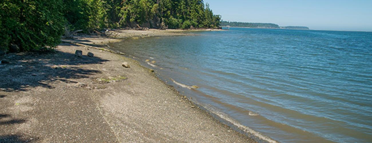
Sequim Bay State Park hugs the western shore of Sequim Bay, which takes its name from an Indigenous village located near its mouth. The bay is protected at its entrance by two spits that have developed over centuries atop a flat section of underwater land. The spits, which nearly enclose the bay, are made up of glacial debris from the last Ice Age—mostly sand and gravel—that eroded into the water from nearby bluffs and was carried by ocean currents. An 800-foot gap between the spits leads into the seven-mile-long bay.
The Rain Shadow
Weather systems approaching Washington from the Pacific Ocean collide with the Olympic Mountains. The moist air is forced to rise, expanding and cooling. Clouds form above the mountains and precipitation falls, as much as 120 inches per year at Bogachiel State Park, less than 60 miles to the west of Sequim Bay. As the air mass passes the mountains and descends over Sequim Bay it warms, evaporating the clouds, rain and fog. The “rain shadow” effect gives the area its famously mild climate, with annual precipitation of less than 10 inches.
Indigenous Lands
Sequim Bay State Park lies within the traditional territories of Coast Salish Indigenous people whose present-day descendants include members of the Jamestown S’Klallam Tribe, Port Gamble S’Klallam Tribe and Lower Elwha Klallam Tribe. For thousands of years this area has provided habitat for a diverse community of life that forms the basis of their cultures.
The S’Klallam winter village of sxʷčkʷíyəŋ (Sequim), located 3 miles north of today’s park, had ten cedar longhouses into the 1880s as recorded by ethnologist Erna Gunther. The village occupied a strategic location with access to a wide variety of resources. Ducks were hunted by suspending nets on poles at today’s Travis Spit, across the opening of Sequim Bay from the village. The bay was noted for its clam beds.
The duck-hunting nets at Sequim Bay were recorded by British Captain George Vancouver during his survey of the Salish Sea in 1792, and US Lt Charles Wilkes mapped the village in 1841.
Local tribes ceded ownership of the area to the US federal government under duress in the Treaty of Point No Point in 1855, keeping rights to harvest natural resources in their usual and accustomed places including Sequim Bay. Most S’Klallam tribal members refused to leave their homeland and move to the Skokomish Reservation as provided for in the treaty, but the arrival of American settlers in the area pressured the S’Klallam to move away from the village site at Sequim Bay. In 1874, under the leadership of Chief James Balch, they purchased 210 acres on Dungeness Bay that became the village of Jamestown. Indigenous residents of Jamestown lost federal tribal recognition in 1953 but regained it in 1981 as the Jamestown S’Klallam Tribe with reservation land at the head of Sequim Bay. Related S’Klallam communities are organized as the Lower Elwha Klallam Tribe (to the west) and the Port Gamble S’Klallam Tribe (to the east).
Bachelor Homestead
Government surveys were completed in 1893 and most of the land in today’s Sequim Bay State Park passed into private ownership as a Homestead Entry patent to John (Jack) Purdy in 1898. The extent of Purdy’s development of the land is not known, but he apparently remained single until his death. His will deeded the land to the State of Washington.
Creating a State Park
On May 3, 1924, 84 acres of the former Purdy homestead was reserved for public park purposes by Commissioner of Public Lands C.V. Savidge. The State Parks Committee accepted the land on November 10, 1924, and authorized construction of a water supply, two small shelters, a community kitchen and comfort stations. The park was dedicated on June 14, 1926.
During the Great Depression in the 1930s, funding was obtained from the Works Progress Administration for further improvements to the park. Facilities were built in the National Park Service Rustic Style with locally sourced stone and timber. Projects included two kitchen shelters, a comfort station, concrete and river rock steps, a ranger residence, and a play field. Workers also constructed an underpass allowing safe passage across the Chicago, Milwaukee & St Paul (Milwaukee Road) railroad tracks that ran through the park.
As in many of Washington’s state parks, the local community has been an important supporter of the park. In 1955, community members raised $40,000 to fund the construction of the Ramblewood Lodge in the southern part of Sequim Bay State Park. Ramblewood remains a popular rental venue for weddings and gatherings.
The Milwaukee Road railway operated freight and timber hauling services on its tracks until 1980. By 1985, the route had been abandoned and track removal was begun. In 1988, a local non-profit, the Peninsula Trails Coalition, began lobbying for conversion of the abandoned right-of-way into a regional multi-use trail extending from Port Townsend to the Pacific coast, the Olympic Discovery Trail (ODT).
In 1989, the Washington State Parks and Recreation Commission purchased the portion of the right-of-way running through Sequim Bay State Park. Development of the ODT proceeded in phases. In 2009, the section of trail along the western shore of Sequim Bay within the park was completed, providing park visitors with an opportunity to bike or walk to a wide variety of local attractions beyond the park.
Sharing the histories of Washington’s state parks is an ongoing project. Learn more here.

