Pacific Pines State Park History
Pacific Pines State Park provides public access to the 27-mile-long beach fronting the Pacific Ocean on the Long Beach Peninsula, a stretch of sand and storm-driven waves dedicated to public recreation.
The World’s Longest Continuous Peninsula Beach
Massive volumes of sand and sediment are carried to the coast from deep in the interior of Washington by the Chehalis River and Columbia River. Once these sediments have emptied into the Pacific Ocean they are moved by waves and coastal currents. In winter months, sediments generally migrate parallel to the coastline. In summer months the sediments are pushed toward the shoreline.
Directly north of the mouth of the Columbia River, the Long Beach Peninsula has been formed by the accretion of sediments supplied by the Columbia River. The long, hard-packed sand beach, easily accessed at Pacific Pines State Park, is touted as the world’s longest continuous peninsula beach!
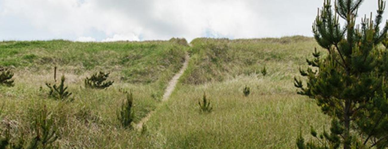
Once the sand has been added to the beach, winds blow the sand grains farther. Predominant winds from the southwest and southeast mold linear dunes parallel to the coastline.
Modifications to the natural ebb and flow of sand on the coast have come from dams that trap sediment on the Columbia River, dredging of navigation channels at the mouth of the Columbia River and the entrance to Grays Harbor, the construction of jetties, and the introduction of non-native plant species to stabilize the dunes.
Indigenous Lands
Pacific Pines State Park lies within the traditional territories of Coast Salish Indigenous people whose present-day descendants include members of the Shoalwater Bay Indian Tribe, the Confederated Tribes of the Chehalis Reservation and other Chinook language-speaking people. For thousands of years the lands and waters of the Long Beach Peninsula have provided habitat for a diverse community of life that forms the basis of their cultures. Salmon species of the Columbia River and shellfish of Willapa Bay are primary foundations of Indigenous lifeways in the region.
Local tribes refused to accept the conditions proposed by Governor Isaac Stevens at the Chehalis River Treaty Council in February 1855. Subsequently, title to the land was relinquished to the US federal government and the Chehalis Reservation was established by executive order of Secretary of the Interior J. P. Usher on July 8, 1864. On September 22, 1866, President Andrew Johnson established the Shoalwater Bay Reservation by executive order.
Government Survey and Land Disposal
Government surveys of the land in today’s park were completed in 1859, and the property was included in a Cash Entry patent purchased from the federal government in 1866 by John Crellin Jr., one of the founders of the town of Oysterville, located five miles north of the park.
As Oysterville’s namesake industry declined due to overharvesting of the resource, the nearby town of Ocean Park grew to cater to vacationers from urban centers in Oregon and Washington. Eventually, a subdivision called Pacific Pines was platted in anticipation of a boom in developing vacation homes.
Wreck of the Alice
Just offshore from Pacific Pines State Park lies the wreckage of the Alice, a French three-masted schooner that ran aground on January 15, 1909. Though members of the local lifesaving service assisted in the rescue of the ship’s crew, the ship itself, loaded with a cargo of cement, slowly sank into the sands under the increasing weight of its curing load. The local narrow-gauge railroad offered excursion rides for curious sightseers to view the wreckage. As was the custom for local residents, some of the cement was salvaged from the ship while still usable. The foundation for a local historic house, The Wreckage, was constructed with the cement, and the building’s log walls and other lumber were salvaged from other shipwrecked vessels.
The wreckage is still visible at very low tides.
Seashore Conservation Area
On March 21, 1967, Governor Dan Evans approved Substitute Senate Bill 414, dedicating “the use of the ocean beaches to public recreation” under the jurisdiction of the Washington State Parks and Recreation Commission (WSPRC). The legislation directed the WSPRC to provide and manage public access points to the Seashore Conservation Area.
Making a Park
At its meeting on August 16, 1971, the WSPRC affirmed the desirability of purchasing land to provide access to two parcels of accreted dunes and beach just north of Ocean Park. The properties had been affirmed as state property by court cases in 1952 and 1960 and were now included in the Seashore Conservation Area. Many such cases had to be adjudicated by the courts to unravel the ownership of accreted lands, as differing rules applied to ownership depending on whether the initial transfer from the federal public domain had occurred before Washington became the 42nd US state on November 11, 1889.
At a special meeting of the board of directors of Pacific Properties, Inc. (the developers of the Pacific Pines plat) on July 14, 1972, the board agreed to sell the parcel of land that became Pacific Pines State Park to the WSPRC.
On July 24, 1972, the WSPRC purchased the nearly 11-acre property from Pacific Properties for $119,000. Construction of a parking lot and restroom facilities were authorized. Park staff, after consultation with local historical organizations, recommended that the park be officially named “Shipwreck Alice State Park” in commemoration of that vessel’s demise. After further consideration of several proposed park names, the WSPRC settled on “Pacific Pines State Park,” noting that its location relative to the widely recognized plat of the same name would “enable local residents to assist visitors in locating the beach access.”
The park was dedicated in a ceremony on June 29, 1973.
Sharing the histories of Washington’s state parks is an ongoing project. Learn more here.

