Skagit Island Marine State Park History
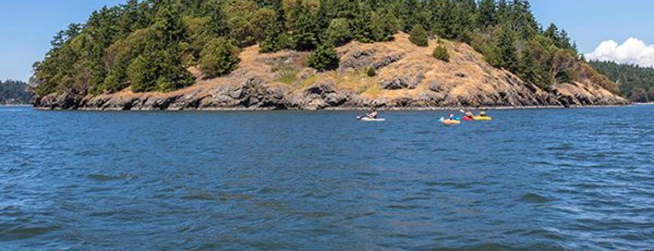
Skagit Island Marine State Park is a delightfully pristine small island located in Skagit County near Deception Pass.
Rock From Spreading Tectonic Plates
The bedrock that makes up Skagit Island is part of a larger assemblage of rocks that outcrop on nearby islands and collectively make up an ophiolite sequence, a distinctive formation of rocks formed where the sea floor has spread apart at a tectonic plate boundary.
Indigenous Land
The park lies within the traditional territory of Coast Salish Indigenous people whose present-day descendants include members of the Samish Indian Nation, Swinomish Indian Tribal Community, Lummi Nation, Upper Skagit Indian Tribe, and Tulalip Tribes. Local tribes ceded ownership of the island to the US federal government in the Treaty of Point Elliot in 1855, keeping rights to harvest natural resources in their usual and accustomed places, including the waters surrounding Skagit Island as well as the land that makes up today’s Swinomish Indian Reservation to the east of the island.
For thousands of years, Indigenous hunters stretched nets on poles between Skagit Island and neighboring Flagstaff Island to catch ducks flying through the narrow gap. Fishers wove weir nets from willow and cedar bark and laid them in the water just offshore. When humpback salmon came into Skagit Bay through Deception Pass and became entangled in the nets, they would be pulled up and brought into shore, providing important food that could be preserved and stored for subsistence through the winter months.
Exploration, Treaty, and Reservation
The US Congress authorized an exploring and surveying expedition by US military personnel to map and gather scientific information about the Antarctic and Australian continents, the Pacific Ocean and the Pacific Northwest in 1836, the first such project by the US government. The US Exploring Expedition (or US Ex. Ex.) set sail from Hampton Roads, Virginia on August 18, 1838, and explored much of today’s state of Washington, by sea and overland into today’s eastern Washington, during the summer of 1841, before returning to New York by completing a circumnavigation of the globe on June 10, 1842.
The expedition’s Commander Charles Wilkes charted today’s Skagit Island as “Skait Island,” in 1841, using the name of local Indigenous people as he perceived it.
In the 1850s, James Alden Jr., a veteran of Wilkes’ expedition, returned to Washington’s inland waterways to complete a survey of the coast as commander of the steamship Active. His survey included recommendations for siting lighthouses and military reservations on points of significant strategic value.
Much of the land that makes up today’s Deception Pass, Skagit Island and Hope Island State Parks was established as a military reservation for the Department of the Army on September 22, 1866. Even though the lands could have been used for advantageous fortifications overlooking the territory’s important waterways, no military installations were ever built.
Becoming a State Park
When members of the State Parks Committee learned in October 1921 of a proposal to lease the Deception Pass military reservation to private individuals, they sent an urgent “night letter,” or overnight telegram, to U.S. Representative Lindley H. Hadley from Washington’s 2nd Congressional District suggesting that the “State Parks Committee would rather have the property turned over to them for care.”
On March 23, 1922, the U. S. Congress passed H.R. 9235, providing that:
…title and fee to all of the land comprising the military reservation…. [is]hereby granted…..to the State of Washington for public park purposes ….
The Washington State Parks Committee formally accepted the grant on April 17, 1922. While much of the parklands developed into Washington’s busy and beloved Deception Pass State Park, Skagit Island has remained an outpost of serenity and solitude. Nearly half of the island is covered with a dense old-growth forest, while a few acres on the southwestern tip of the island support a wildflower-filled grassy bald.
Cascadia Marine Trail
In the mid-1950s, a veteran of the World War II 10th Mountain Division, Tom Steinburn, one of the first mountaineers to reach the summit of Alaska’s Denali, joined with Washington mountaineer/geologist Wolf Bauer to begin exploring the reaches of Puget Sound by kayak. He noted that when traveling by kayak “your equipment carries you instead of you carrying your equipment.”
He would go on to help found the Washington Water Trails Association and advocate for the 1993 establishment of the Cascadia Marine Trail, a 150-mile route on the waters of Washington’s Salish Sea honoring the water transportation utilized by the region’s Indigenous people for thousands of years. At the June 26, 1999 event recognizing the Cascadia Marine Trail as one of 17 National Millenium Trails, First Lady Hillary Clinton said that the trails “tell the story of our nation's past and will help to create a positive vision for our future.”
Skagit Island Marine State Park hosts a primitive campsite designated solely for use of human-powered boaters as part of the Cascadia Marine Trail, along with sites in about 30 other Washington State Parks.
Sharing the histories of Washington’s state parks is an ongoing project. Learn more here.

